

Britain's geospatial data is a huge mess
The Postcode Address File is far from the only problem.

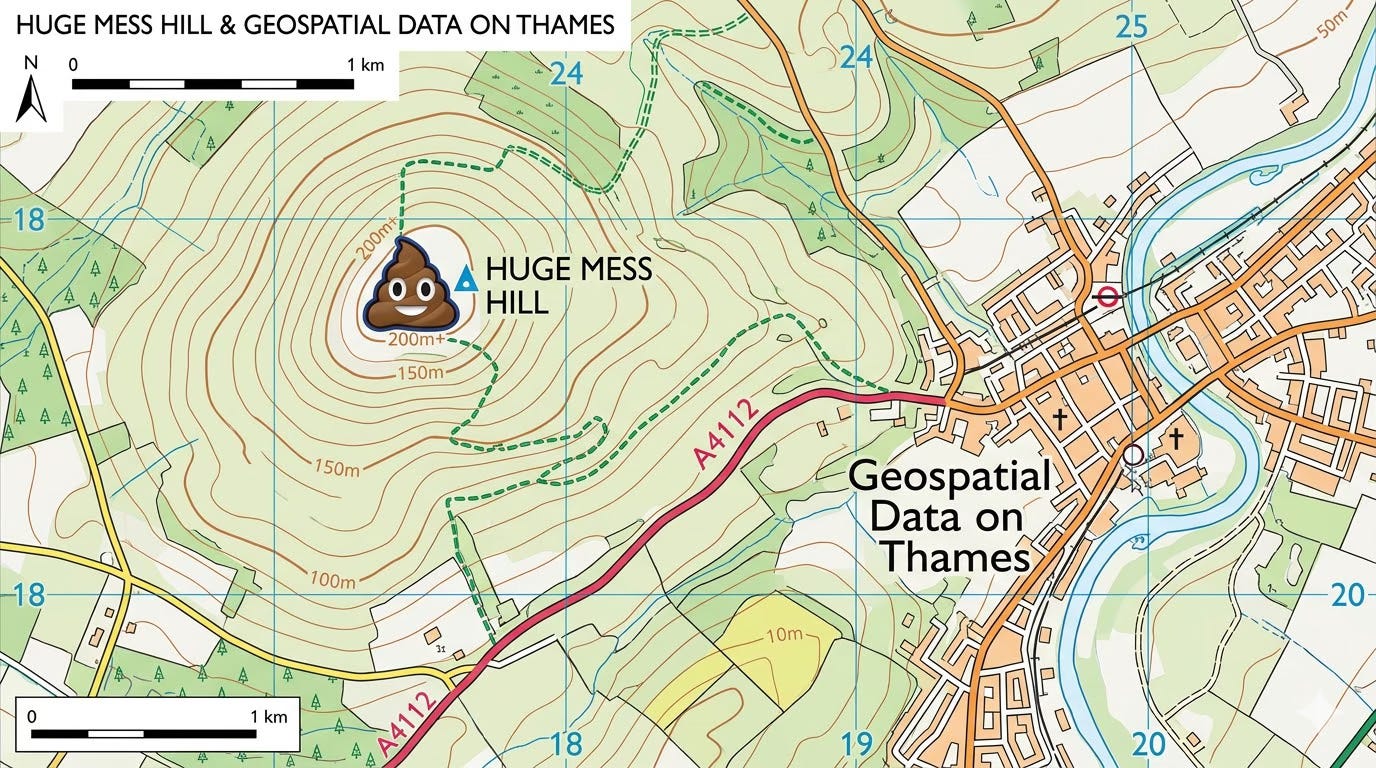
I’m old enough to remember paper maps.
When I first started driving, if I was heading on a long journey I’d look up directions on the AA route planner on Windows, and I’d print out the instructions, occasionally pulling over en route to check that I was still heading in the right direction.
It’s strange to think about now, as with only this prehistoric technology, I attempted trips I couldn’t even conceive of trying today without the aid of GPS, such as heading into central Birmingham’s nightmarish inner ring-road system in search of the Carling Academy.1 It was a world where a single wrong turn could send me on a mystery tour around the West Midlands.
So this is all to say it was a relief when consumer GPS devices first started appearing in the late 2000s. Thanks to a network of two-dozen-or-so satellites in the sky,2 I’ll never get truly lost again. And today the technology guides me on every significant car trip – even on routes I know well, as I like the reassurance that Google Maps will identify potential traffic problems or road closures ahead of me.
However, my navigation woes were not the most important thing about the emergence of GPS technology. The satellites had originally been created for military use, and civilian use was limited by the data being made deliberately fuzzy, reducing the accuracy and making it unworkable for many use cases. But in the year 2000, with the stroke of a pen Bill Clinton ordered the end of ‘selective availability’, and unlocked a huge amount of economic and social value that today benefits the entire world.
With GPS signals freely available to any device with a compatible chip, countless new use cases for the technology emerged. This ranged from big-deal things, like tracking aeroplanes and ships, and new industrial uses like precision agriculture, to small improvements to how we live. For example, it’s thanks to Bill Clinton that the McDonalds app can tell you which of their restaurants is nearest, without the need for you to enter an address first.3
What’s most important about the value created, though, was that none of these uses were strictly envisioned by the creators of the GPS system. Nobody in the Pentagon in the early 1970s was thinking “one day, our grandchildren will catch Pokémon with this technology”.4 But these new capabilities simply emerged as smart, innovative people took this new freely available source of data, and built new things with it.
And as a global society, we’re all richer and have easier lives because of it.

GPS is, then, the perfect parable for why freely accessible geospatial data is good. And it’s my view that opening up more geospatial data can only be a good thing. In a sense, this is the exact thing a government should be doing: It has the scale and capability to collect and maintain datasets that no start-up can match. And if it gives people the opportunity to play with our most fundamental geospatial data, they might just invent the next big thing.
However, this brings me to Britain’s huge geospatial problem. Even though the potential value to society of geospatial data the government already holds is enormous, too much of it remains locked away. Geospatial datasets are often hard to obtain, and eye-wateringly expensive. And some of our best data is trapped inside institutions that were designed for a world of analogue, paper-based maps.
And it’s really time for us to fix it.
Let’s be real, if you’ve read this far into an article about geospatial data, my newsletter is for you. Subscribe – for free – to get my stuff in your inbox.
A broken landscape
Let’s start with something basic like address data. That’s right, regular readers, I’m going there again.
Say you’re a small business, or a hobbyist coder in a bedroom, and you have a great idea for a new app or service, which relies on address data to do something clever. Maybe it’s something futuristic, like a drone delivery service. Or maybe it’s something more mundane, like an app that reminds you when it is bin night.
Either way, the data you’ll need – the address of almost every building in the country – is in the Postcode Address File (PAF). To license the PAF, before you can even publish your project, you’ll need to find £7,525 a year to pay to Royal Mail for the privilege.5
I won’t bore on, as I’ve written about the PAF problem once or twice before, but suffice to say that in my view this amounts to a tax on innovation.
However, the PAF is only the tip of the iceberg.
The most important player in terms of geospatial data is probably the Ordnance Survey (OS), the government mapping agency.
This is a very unusual body. Although it is owned by the government, it is a structured as a private limited company, and is obliged to try to pay for itself with its activities, rather than rely on the taxpayer.
And it does this by producing a bunch of different data products, some of which are free to access, and others which are paid.
For example, one product is called AddressBase, which is like an enhanced PAF. It takes PAF data (licensed from Royal Mail), and links addresses to Unique Property Reference Numbers (UPRNs), which are unique ID numbers for individual properties.6
But even though the UPRN numbers7 themselves are legally totally free open data, you still have to pay, because AddressBase uses PAF data.
Or another example is roads data. If you like, you can download for free the OS Open Roads dataset, which contains a basic map of Britain’s roads. But if you pay, there’s the OS MasterMap Highways Network dataset, which is the same thing but augmented with other road data, like turn restrictions, weight limits, and the locations of bollards and traffic-calming measures.
In my view, the way the OS splits this data up between free and paid is slightly weird and arbitrary. And having to operate like a private company leads it to doing some very strange things, such as rather than simply make maps and geospatial datasets for public benefit, it spends money on marketing – like this sponsorship with the excellent Map Men.
But this is far from the only weirdness. For example, if you want to work out who owns a given piece of land in England or Wales, that data is stored by the Land Registry, a separate arm’s-length body, and again you have to pay for the privilege.
And remember the UPRNs I mentioned above? The actual designation of a given UPRN to a specific building isn’t done by Ordnance Survey – this is done by another body, called GeoPlace, which is a company that is co-owned by OS and the Local Government Association, the latter of which is a body that represents all local councils together.
I could go on, but to understand the upshot of all of this, think about something as simple as your address: Ordnance Survey (part of the government) own the visual map of where you live, Royal Mail (a Czech-owned private company) own the postal address, GeoPlace (don’t ask) assigns your home’s UPRN, and the Land Registry (a different part of the government) holds the details of who owns your house.
A mad system
If you’re confused, this is the correct reaction, as none of this makes any sense.
This is because it’s an institutional arrangement that has evolved over the decades and, in the case of OS, centuries, because it was first founded in 1791.
And looking at these different datasets is like looking at layers of sediment to date dinosaur skeletons. Why do different organisations maintain and own different bits of geospatial data? Why are some datasets released as free, open data, and others are closely guarded intellectual property that requires a fee? Why are held by the public sector, and others private?
There’s no consistency or logic underlying the design of this arrangement, because it wasn’t designed. It’s simply a reflection of the prevailing business model logic of the time they were created, and bureaucratic inertia since.
For example, you can imagine how charging for Ordnance Survey maps might have made sense in a pre-internet era, when selling paper maps was literally something the government used to do – and when the only notable ‘data’ customers would have been publishers creating road atlases.8
Similarly, of course UPRNs are free and open, because they were created during the digital era, when clarity on specific locations is important for digital tools and nationwide digital services. And it would just seem crazy on its face to lock this behind a paywall.9
Taken together, then, in 2026, none of the ways we handle geospatial data actually makes any rational sense.
And even worse, the current mess isn’t just inelegant. It makes doing anything with geospatial data much more difficult, and leads to some maddening decision making.
For example, a while back I wrote about an effort to digitise Traffic Regulation Orders (TROs). This is a great idea as, over time, it will effectively create a free, open data map of the rules and regulations governing every road in Britain. It’s easy to imagine it being extremely useful for planners, parking apps and autonomous cars.
But as I understand it, when the programme was in development, it reached an impasse with Ordnance Survey. Because there was a concern that, as the database is slowly built up by feeding in TRO data from different local authorities, that it could inadvertently replicate existing address datasets like the PAF and AddressBase, effectively exposing their valuable data for free.10
So to get the digital TRO system launched, a compromise was reached where stored location data would, like pre-2000 GPS, be deliberately fuzzed up and made less accurate by the Department for Transport’s software, knocking each location off by a few dozen centimetres to make it just inaccurate enough to avoid creating any legal problems.
In other words, because of the mad way Britain governs and licenses its geospatial data, we’re creating worse, less accurate datasets, and we’re slowing down their creation with legal paperwork. Which doesn’t seem great.
Stop your messing around
The reason I bang on about geospatial data with frankly alarming regularity is because, though these sound like esoteric data issues, this is important.
There are few more foundational datapoints about Britain than its geography, and if we can make this data free, open, and available for anyone with a good idea to build with, it can catalyse economic growth.
And, like I said above, I think collecting and providing this data is exactly what government should be for in the 21st Century.
Just as the government provides a police service so that individuals do not need to hire security guards, and just as it provides roads so that we can all get around, providing foundational datasets will create new opportunities for innovation.
So the obvious thing to ask is… can we fix this broken system and get a grip on our geospatial data?
The optimistic view is that there could soon be a huge opportunity to do so, thanks to the blank void that is the government’s planned National Data Library (NDL).
I’ve written about the NDL before, but the short version is that it’s basically a catchphrase in search of a policy. Promised in the Labour manifesto, it was essentially a cool-sounding bucket into which the government could throw any vaguely data-related issues, and for the last couple of years there has been a team in DSIT trying to work backwards to figure out what it should be.
And here’s whereI think the opportunity lies. If the government is serious about the NDL making data easier to share – like a library does – then geospatial data is an obvious place to start.
The government should use the NDL as the excuse it needs to wrangle addresses, maps and property datasets into some sort of order, and open them up so that small businesses, start-ups and bedroom coders can use them to build.
So let’s make this Britain’s GPS moment, where we open up our geospatial datasets, unfuzz the current mess – and make it clear where Britain’s most useful data is headed.
If you read this much about geospatial data then you’ll definitely like my newsletter. Subscribe (for free!) to get more like this direct to your inbox.
I’m pretty sure that neither Carling Academy or the ring road exist anymore.
There are currently 31, the system needs a minimum of 24 to operate.
I learnt recently, thanks to a comment on my newsletter, that in the 90s it was apparently a running joke about how Bill Clinton likes McDonalds. It’s a meme that I was completely unaware of, because I guess Trump has taken on this mantle now.
I think that warm summer weekend in 2016 when Pokémon Go was first released might have been the last time anyone was truly happy.
The PAF is cheaper if you just want one copy to update a spreadsheet in your back office, but the second you start doing something interesting with it, the costs pile up.
You rarely see UPRNs publicly but are still absolutely critical for some uses. For example, my mortgage documents contain my house’s UPRN to make it absolutely clear which building the documents are referring to.
This footnote to acknowledge everyone getting mad at at me saying “UPRN numbers”. To those people I say “STFU up”.
Likewise, back then it would have made sense for the Land Registry to charge fees to access its data, as accessing records would have required significant human labour, with employees having to comb through mountains of paper records to find what is needed.
Someone told me once that before the creation of iBus in the early 2000s, Transport for London didn’t actually have a database of its bus stops, with their location data. And this makes sense to a degree, as beforehand no one was using a digital journey planner.
For the ultra-nerds: I believe this is why it wouldn’t be covered by the Public Sector Geospatial Agreement.
The Carling Academy still exists and is now known as the O2 Academy.
Birmingham's inner ring road is no longer designated as such and traffic is encouraged to use the less central (formerly "middle") ring road; those parts that do remain are now lower-volume local roads or bus-only.
Ah, it’s the Free Our Data campaign, rising from its slumber! We did have some success in 2010 when OS released a certain amount of data for free at the instruction of the Brown government - before that it had everything behind a paywall guarded by lawyers. So it’s better now but as you point out, very far from ideal.
The “trading fund” model is the problem - Land Registry and OS and UKHO and others are obliged to wash their financial faces so that government doesn’t have to put mo eg in - but this of course ignores, as with GPS, the potential for new or faster uses of the data currently guarded by three-headed lawyers.
Perhaps it needs a position paper sent to a minister, and multiple opposition shadows, pointing out how this should be reorganised and how the benefits would accrue. The government is happy to shovel £1bn down the hole of quantum co
Pouring, which it isn’t going to see back for a long time. Why not some smaller amounts so we can get to do unpredictable but financially beneficial things with the combination of all that data? What are they worried about - that people will find out where the potholes are and repair them more quickly without having to license a dataset? That self-driving cars will have better data for more roads?
Unfortunately we need a minister with the vision of Tom Watson, who pushed change through when he was in Cabinet Office (and his Tory successor Francis Maude to be fair) rather than the dim bulbs we seem to have just now.