Yes, AI really can be used to tackle potholes
It's not bullshit, it's already happening.
NEW EVENT! Tickets to the Odds and Ends of History February event on (relevantly) how AI can (maybe) fix the state are available now. Book now to avoid disappointment!
The chuntering was almost deafening.
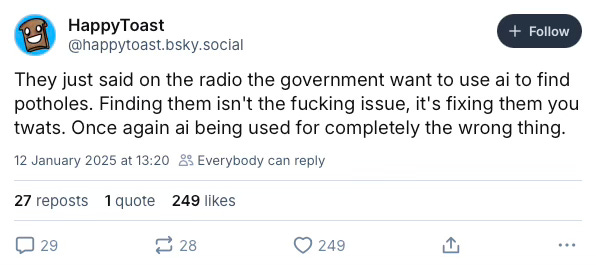
When the government launched its AI action plan on Monday, one of the lines briefed out to journalists was that the new technology would be able to help local councils detect potholes.
The intention was clearly to offer a tangible, real-world example of how AI can improve our lives, and to provide some colour to illustrate a report that is focused on more abstract concepts like “sovereign compute” and “frontier models”.1
However, If social media was any indication, a lot of people were unconvinced by the idea.
My reaction though was rather different.
Over the last few years, I’ve written about many of the ways that data can improve our transport infrastructure. For example, virtual queuing could make the Channel Tunnel less of a nightmare, AI cameras could revolutionise Tube station operations, and mobile phone location data helps transport planners model our movements.
So when I heard that AI could be used to tackle potholes, I wanted to learn more. And the answer was not hard to find.
In fact, the technology is being or has already been used on British roads for this purpose today, in places like Surrey, Kent and Medway – as well as London. And it’s clear that AI really can make a difference to how we maintain our roads.
If you enjoy nerdy politics, policy, tech and transport takes, then subscribe (for free!) to get more stuff like this direct to your inbox.
Potholes vs AI
The way that your local authority currently maintains the roads is probably pretty torturous. Typically, the council employs a team of highway safety inspectors, whose job it is to go out every day and survey the roads. Depending on how important the road is, inspections could be, say, monthly, quarterly, or every six months.
These inspections are not only focused on potholes. They’re also surveying for other roadside hazards, like broken or obscured signage, and overflowing vegetation. If they notice something wrong, they’ll typically have to park up, get out of the car, take a photo of the problem and take down all of the information the maintenance team will need to come and fix it.2
Essentially then, the current method of maintaining the roads is a time consuming, laborious process.
It’s also far from foolproof. For example, often inspectors will ignore smaller problems. Say, a chip in the road that hasn’t yet grown large enough to be a problem, because the hassle of the paperwork and the time constraints on the inspector outweigh the need to stop and deal with it.
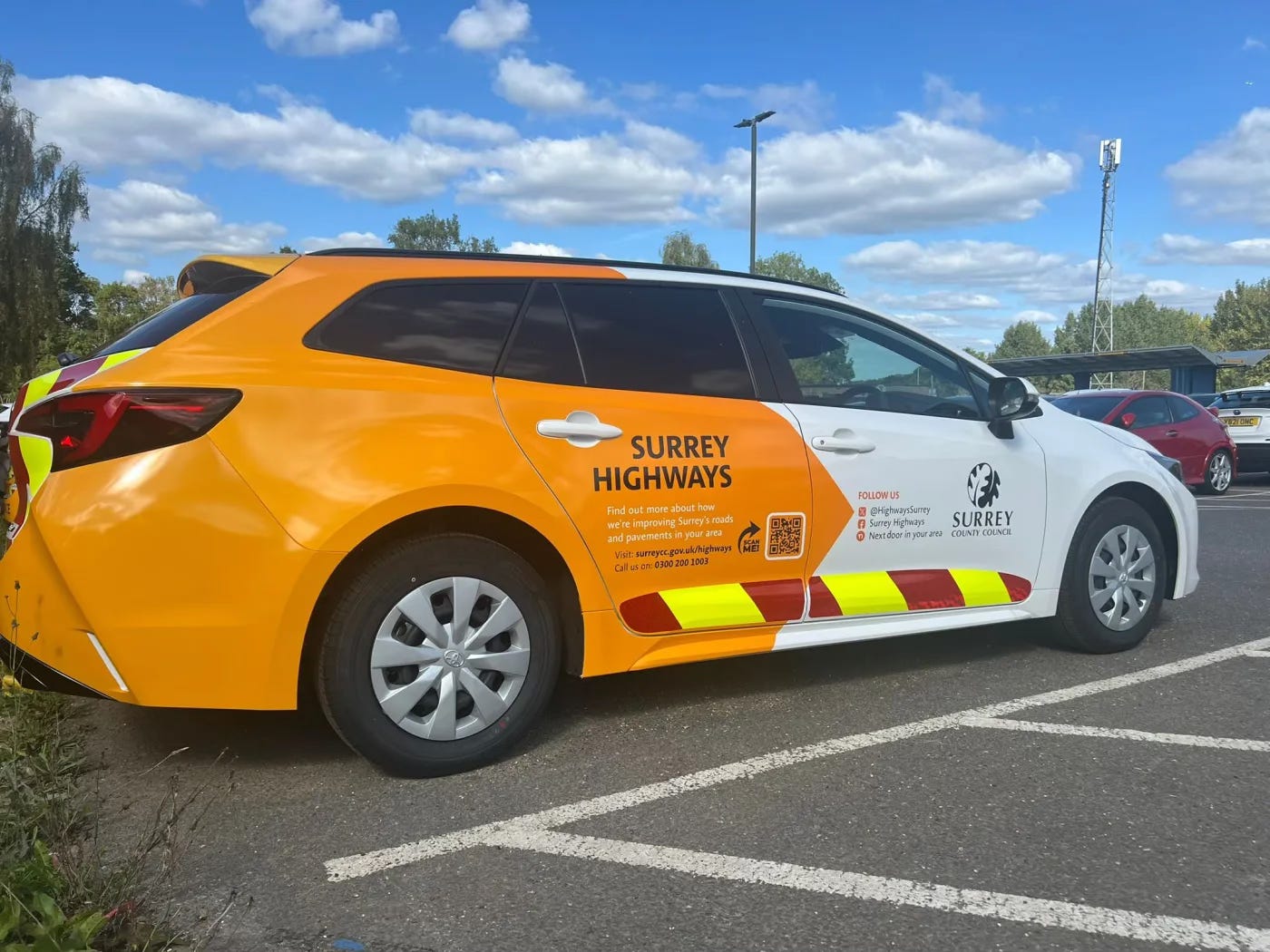
So how might AI change this? One example is what Surrey County Council is doing. Seemingly coincidentally earlier this week, the local authority announced that it was rolling out technology from a company called Route Reports – one of several players in the space.
And to use Route Reports as a case study, the way their system works is pretty clever.
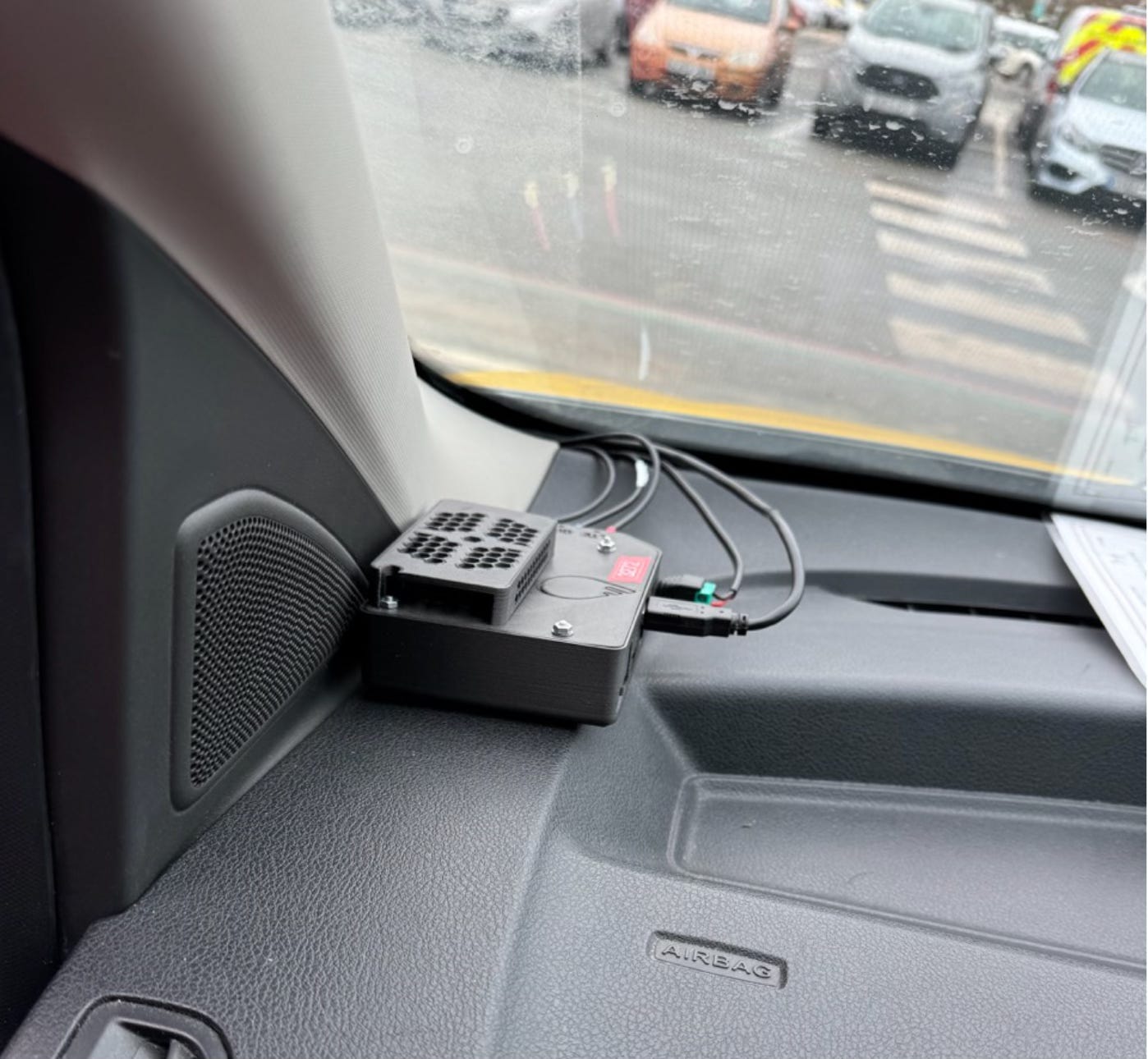
Essentially, all of the Surrey’s road maintenance vehicles have been fitted with what you can see above – a small black box that’s connected to a camera on the front of the car. The computer contains an Nvidia chip that has been specifically designed for AI image processing, as well as a GPS receiver, and a 4G internet connection.
Together, this enables the road maintenance team to automate the most annoying parts of their work. Instead of having to stop and get out of the car when they spot a problem, they can simply… continue driving.
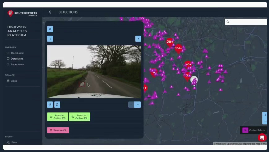
As they drive along, the AI chip analyses the camera images to look for potholes, cracks in the road, signage and vegetation problems and uploads the photo to a cloud platform. If it spots anything, it automatically flags up the problem, and creates an incident report on the system for the maintenance team to investigate.
Exactly how good is it? I’m told that the system has been validated against road maintenance staff surveying using the traditional manual method, and it can today achieve upwards of 95% accuracy, in terms of matching the humans.
The reason it is seemingly this reliable is partially due to the powerful on board chip. I’m told that the camera runs at 4K, 60 frames per second, to ensure that it captures the road accurately, even if the car is barrelling along at 60mph in busy traffic.3
And what’s cool is that the system will even calculate the width, length, and depth of potholes it discovers – which means that those problems that are too small for a human inspector to bother with can be noted down before they become a problem, and maintenance teams have more data to help them prioritise.
More than potholes
Perhaps the real value of a system like this though is not just in terms of identifying potholes. That’s why this is ultimately going to be a better solution than, say, a platform like FixMyStreet, which helps citizens send letters to their local council to flag up potholes and broken street furniture, and so on.4
What makes this sort of automation valuable is that it turns what was a relatively ad-hoc process into routine data collection – which has numerous emergent uses.
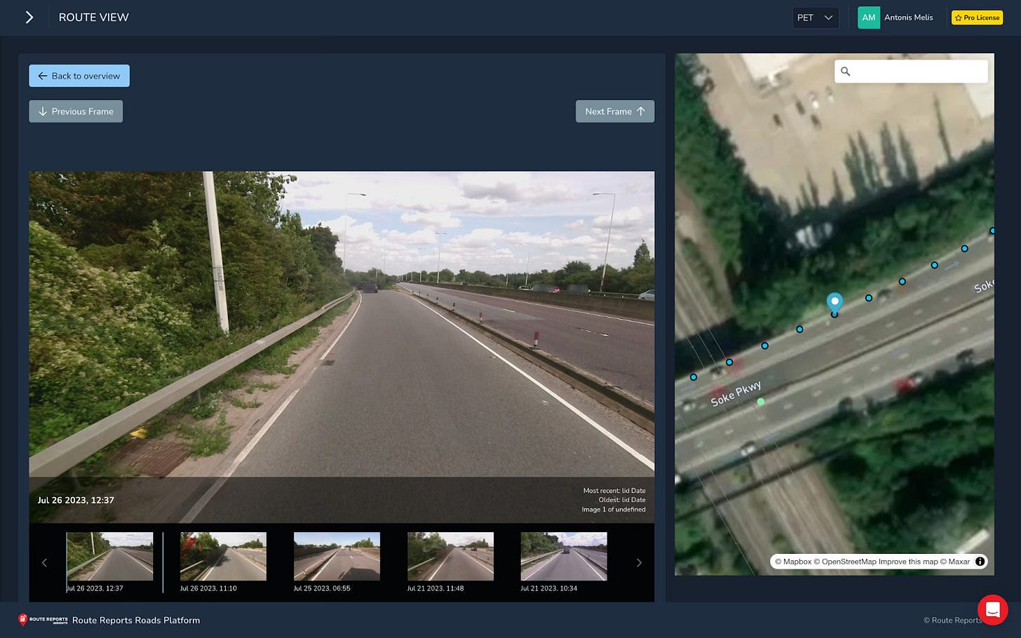
For example, the way Route Reports’ platform works is that the cameras take a photo every ten meters while driving along, in addition to the AI-identified pothole photos. So in effect, this means councils can passively build up their own Google Streetview-style map of their local area – but instead of only updating once every few years, it is instead updated every few days.5
And as a result, the platform can save time on other council tasks too. For example, say a contractor has been sent out to paint some road markings. Instead of having to drive out to check their work, the council can just click on the map of passively collected images to see what the road looked like last time a council vehicle passed.
I’m also told by Route Report that typically once the system is in place, other departments start taking an interest too.6 For example, fly-tipping enforcement or the planning department could conceivably use the same maps to check roads and properties relevant to their interests. Or the environmental services department could check footpaths caught on the cameras to see if the grass is too long by the side of the road. I’m also told the map is being used to check trees for ash dieback – a fungal disease that can wipe out woodland if left unmanaged.
Roving sentries
So in a nutshell, that’s how AI can be used to detect potholes – and so much more.
There are currently several companies out there selling technology similar to this at the moment. In the case of Route Reports, they’re either working or have worked with 15 local authorities around the country, as well as municipalities in other countries. So using AI to tackle potholes is not some crazy, science fiction idea – it’s already being done.
And we can see the results in Britain. In a trial a few years ago, Transport for London concluded that “This technology has delivered better analytics which could enable more efficient maintenance, reduce the number of reactive repairs and improve network reliability.”
And Kent County Council was similarly positive when it tested the road-monitoring computers by mounting them on county buses. Its report noted the potential for how continual passes could help them build up profiles of defects on the road and model the degradation to predict what might go wrong.
Then there is Surrey. This is the most significant moment for Route Reports at least, as it marked the first time that their technology has been wholly adopted by a council. During previous trials in other places, maintenance teams had continued to carry out their traditional duties alongside the AI – meaning that many of the benefits in terms of maintenance speed and capacity may not have been realised.
But from now on in Surrey? There will be no routine manual road inspections. AI will simply be how Surrey does road maintenance.
Operationalised AI
The more sophisticated form of cynicism is to react negatively to the idea of AI pothole maintenance not because it sounds silly but because “finding them isn’t the issue”, and to point to how the real pothole problem is that local authority funding has been disemboweled by a generation of austerity.
I don’t disagree – I think councils have been badly hurt by having less money too. But this criticism doesn’t work as the role of AI here isn’t just about identifying potholes – it’s about carrying out road maintenance more effectively.
Contrary to the cynics above, this is something we should want, because there will always be more potholes to fill, signs to fix and verges to cut than there is budget to fix them. And it will always work out cheaper to perform predictive or preventative maintenance, before something goes wrong.
So don’t laugh or despair at using AI to tackle potholes – embrace the idea as it could make a real dent in the cost of road maintenance.
You made it to the end! If you enjoyed reading, subscribe (for free) to get more nerdy politics, policy, tech and transport takes direct to your inbox.
Oh, and one last plug my AI event on the 25th Feb. Come along and hang out with us – and learn how AI can fix public services, a bit like the above.
I’m told that some councils handle this in-house, while larger councils will sometimes contract out this sort of maintenance to construction companies.
I’m not sure if it is still the case, but when I first tried an autonomous car in 2014, which was being tested by Nissan, I was shocked to learn that images used for navigation were shockingly low resolution – think of the order of 320x240. This is because image processing was optimised for speed, as real time matters when you’re navigating a car. Anyway, that sort of resolution might work for spotting pedestrians – but no way is it going to spot minor cracks in the road. So no wonder they need something more powerful.
Though I want to be clear that the people behind FixMyStreet, which launched in 2012, are absolutely civil society heroes.
Another reason for the hefty Nvidia chip is because it does all of the privacy-conscious face blurring locally, before sending the images to the council, to avoid any GDPR nightmares.
I know they would say this as they’re trying to sell their platform, but this sounds entirely plausible to me.









As someone who used to work in a County Council Highways and Planning department, I found this very interesting.
A few comments - if this had been done 10 years ago, I suspect AI wouldn't have been mentioned - it would have been called "automated image classification" or something similar.
On preventative maintenance, there is a lot of stuff in the operational research literature about optimum maintenance strategies, and I doubt if repairing every small defect wherever and whenever they appear is optimal.
Perhaps "AI" or whatever you want to call it can help in developing the maintenance and inspection programmes and schedules
Is this an example of how the umbrella term 'AI' has been toxified by ChatGPT-style bullshit? I might be misunderstanding here, but is the pothole stuff with onboard chips of a different character entirely to LLMs? Seems to be more 'sensible use of technology' rather than 'planet burning IP theft machine'? Genuine question really.